Washington, DC— It is imperative that society learn more about how climate change contributes to episodic and very severe water quality impairments, such as the harmful algal bloom that caused Florida to declare a state of emergency earlier this month, says Carnegie’s Anna Michalak in a commentary published by Nature.
“The scientific community has made remarkable progress in understanding the role of climate in the occurrence and intensity of droughts, storms, and other extreme events relating to water quantity,” Michalak writes. “It is time for a similar examination of extremes in water quality.”
These severe and periodic water quality issues are a growing problem around the world and affect water that is used for drinking, growing crops, raising livestock, bathing, domestic chores, and recreation. They range from harmful algal blooms, to hypoxic “dead zones,” to contamination from bacteria, viruses, and chemicals, among others.
“Cases of extreme [water quality] impairment often lead to disproportionate human and ecosystem impacts,” Michalak writes. “The costs can be huge.”
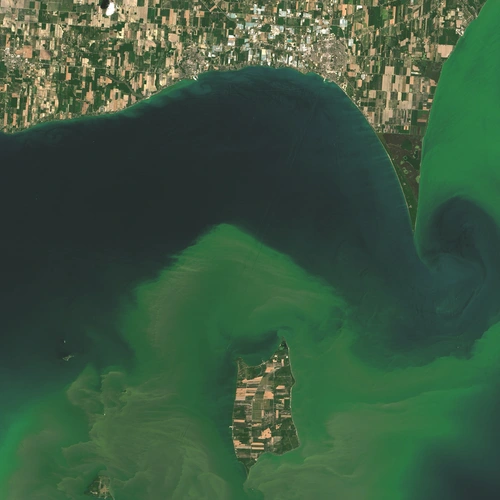
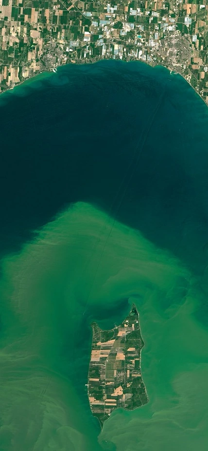
Last year, a toxic algal bloom in Lake Erie was the largest ever recorded, spreading well over 100 miles across most of the lake. A similar 2014 Lake Erie bloom spurred city officials in Toledo, Ohio, to warn more than 500,000 neighboring residents against drinking their tap water, because it contained liver toxins 2.5 times higher than the safety standards set by the World Health Organization.
Another harmful bloom last year stretched between Baja Mexico and Alaska in the Pacific Ocean, this one dominated by neurotoxin-producing diatom algae. It shut down fisheries, including delaying the Dungeness crab season by months, and caused severe brain damage in sea lions.
Most severe water quality issues are exacerbated by weather. As climate change alters weather patterns, the conditions that create severe water quality problems are likely to become more frequent, Michalak argues.
“We do not know how to relate water quality extremes, their causes, their severity, or their occurrence directly to changes in climate,” Michalak writes. “There is a pressing need to understand which meteorological conditions, in what combination, make extreme water quality impairments most likely.”
The three harmful algal bloom examples listed above have both commonalities and differences. The immediate causes differ:
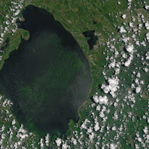
- In Florida, heavy rainfall led to a decision by the Army Corps of Engineers to release water from Lake Okeechobee into the St. Lucie Estuary to prevent flooding. The resulting pulse of nutrient rich water triggered the bloom.
- In Lake Erie, farming in the surrounding area leads to fertilizer being flushed into the lake each year. The amount of fertilizer and its impact on the lake are affected by rainfall patterns and lake circulation, which is itself also impacted by temperature and winds.
- On the West Coast last year, unusually warm waters in the Pacific likely contributed to the growth of the bloom.
Looking deeper, however, all of these extreme events can be linked to weather events. And meteorological patterns are affected by changes in climate. As weather patterns become more “extreme” under climate change, so will water quality impacts.
Once scientists learn more about the links between climate change and extreme water quality, they must use this knowledge to inform the broader global discussion around water policy, Michalak adds.
Last autumn, for example, the United Nations adopted 17 Sustainable Development Goals for 2030. One of these was to “ensure availability and sustainable management of water and sanitation for all.” In order to achieve this goal, it is necessary to understand what drives extreme impacts on our waters, and to figure out how to anticipate what the future holds for the water that is crucial to nearly every aspect of our lives.

Caption: An image of the algal blooms in Lake Erie taken in July 2015. NASA Earth Observatory images by Joshua Stevens, using Landsat data from the U.S. Geological Survey.

Caption: An image of algal blooms in Lake Okeechobee this year. NASA Earth Observatory images by Joshua Stevens, using Landsat data from the U.S. Geological Survey.
