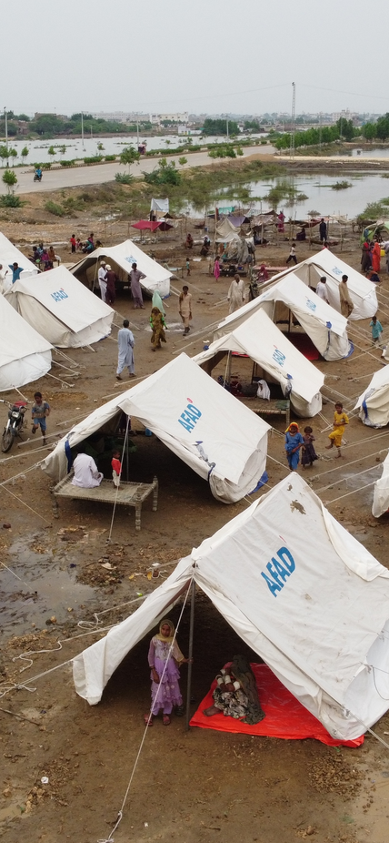
Washington, DC—Researchers from Stanford University’s Natural Capital Project, including Carnegie collaborators Edgar Virgüez and Ken Caldeira, reviewed the impact of 2022’s flooding in Pakistan, offering insights on how to rebuild with future floods in mind and demonstrating that climate adaptation measures could have helped many of those impacted. Their findings are published in Environmental Research Letters.
Last summer, Pakistan’s Indus River overflowed and swept through the homes of at least 30 million people, killing at least 1,700 and displacing 8 million. The economic cost of the flood’s damage was estimated at $30 billion. The research team worked together to calculate the approximate depths of flooding in different areas and the number of people affected by the natural disaster. This data formed the baseline of their forward-looking analyses.
“We were motivated by these big floods that are happening now every year, to ask: how can we conduct a very high-level assessment of what it would cost to adapt livelihoods to a changing climate?” said first author Rafael Schmitt, a leading scientist at the Natural Capital Project, an interdisciplinary Stanford-led initiative to motivate greater investment in natural resources, including land, water, and biodiversity as national capital. “This could help countries and international donors evaluate the cost-effectiveness of specific adaptation measures.”
A New Climate Adaptation Decision-Support Tool
The researchers addressed two main options for adapting to future flooding in Pakistan, both of which have been widely implemented across Asia: “moving up” by building elevated structures, or “moving over” by temporarily relocating when floods occur. The depth of flooding–and distance to dry–are important factors for determining which response makes sense. Locations with shallow flood depths that are far from dry land would favor elevating buildings, while flood depths of greater than two meters make elevated structures impractical and too costly.
The team integrated satellite data from flooded locations with hydrologic principles and demographic data on population density, housing, and other infrastructure. This produced a rapid overview of flood severity and exposure.
The researchers estimated that 26.6 million people in Pakistan were exposed to less than 1 meter of water, 7.4 million were exposed to water levels between 1 and 2 meters, and 5.7 million were exposed to more than 2 meters of flooding.
Based on this and proximity to dry land, the researchers determined that there were 5.1 million people for whom the “move over” would be the best solution, 6.3 million people who would be best served by “moving up,” and 27.5 million people for whom either “moving up” or “moving over” could work. Additionally, half a million people were categorized with retreat as their only option. These individuals experienced flood depths greater than 2 meters and they were far from dry land.
Focusing on those who experienced flood depths between 1 and 2 meters, the researcher’s analysis estimated adaptation costs between $1.5-$3.6 billion, in addition to the $5.8 billion to rebuild housing to the status quo.
"This work demonstrates how a data-driven approach to policy and planning can help communities prepare for the oncoming challenges of climate change,” said Caldeira. “As scientists work hard to help develop climate change mitigation strategies, we can also apply our skills to provide information needed to assess risk and determine the best paths forward to prevent human catastrophes in a warming world.”
Prioritizing Equity and Resilience in Rebuilding Efforts
This research effort only looked at housing, but the team’s analytical tool could also be applied to other types of infrastructure, including roads, schools, and hospitals. And in the future, data from NASA’s Surface Water and Ocean Topography satellite could enhance its abilities.
“The study speaks to the potential to incorporate science-informed adaptation measures into reconstruction and disaster response, helping in investment prioritization,” said Virgüez. “This is particularly useful nowadays with the discussions on mechanisms to compensate countries of the Global South for climate-change-attributed damages.”
The researchers emphasized that tools such as theirs can help ensure that reconstruction funding is directed where it can make the greatest impact, not because it will benefit those with the most influence.
“Countries of the Global South, like my native Colombia, would benefit from process-based model assessments at scale and in a timely manner that can guide the investments of scarce resources. Especially since many of these countries lack timely-generated data, which complicates strategic decision investments,” Virgüez added.
An important outcome of the United Nations Climate Conference last year (COP27) was the creation of a new Loss and Damage Fund to provide financial support for countries that are most vulnerable to climate change. In this paper, the research team urged funders and governments to rebuild with adaptation in mind. To do that, they say, more science should also be directed toward understanding low-cost adaptation options.
“Flood models are data-intensive, and you need specialized knowledge to run them,” Schmitt concluded. “We need adaptation research that is easier to use and act on.”
